Wednesday, January 10, 2024
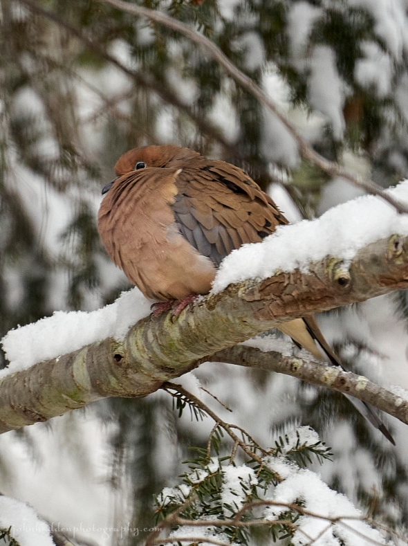 A mourning dove naps in the hemlock near the feeder
Well that certainly was a noisy night! I’m guessing that many of you are out of power this morning in the wake of the wind. We lost power here around 11:30PM last night—it’ll probably be a pretty long outage…
Morning Observation:
This morning in Huntington at 6:35AM it’s currently 42 degrees and raining under cloudy skies. Winds are out of the west at 5-7 mph. Relative humidity is 93%, dewpoint 41, barometric pressure 28.99”. We picked up 0.47” of rain/melted precipitation so far today. We had 3” of sodden snow on the storm board this morning, but whether that is new snow or just drifted snow is anyone’s guess. I’m guessing more the latter. We have 4.5” at the stake. We had a top wind gust of 54 mph overnight which is a new record for us. Yesterday’s high was 37, and yesterday’s low was 21. The overnight low got down to 37.
This morning in North Hero (where the power is still miraculously on…) it’s currently 40 degrees and raining under cloudy skies. Winds are light out of the west. Relative humidity is 97%, dewpoint 39, barometric pressure 28.98”. We picked up 0.01” of rain/melted precipitation yesterday and 0.03” so far today. We have about 2” of snow at the stake, though it looks like there’s a fair amount of scouring to the ground in places. We had a top wind gust of 42 mph. Yesterday’s high was 38, and yesterday’s low was 24. The overnight low got down to 38.
The High Wind Warning has been cancelled.
Forecast Discussion:
Morning radar imagery shows low pressure over Lake Superior with an occluded/cold front running southeastward from the low down into Connecticut. Rain is stretched along this frontal boundary, and we should see one more round of heavier rains before precipitation becomes more showery in nature this afternoon. Gusty southwest winds are also expected to develop this afternoon. Highs today will top out in the mid 40s and start dropping this afternoon. Any lingering precipitation will change over to snow at higher elevations later today, with snow levels gradually dropping into the valleys by this evening. Little or now snow accumulation is expected. After a brief break in the precipitation tomorrow morning, an upper level shortwave will bring some snow showers in the afternoon, especially over the northern mountains where we may pick up an additional 1″-2″ of snow. Friday’s looking dry and seasonable as a brief ridge of high pressure builds in. Another impactful storm system is expected later Friday night into Saturday. At this point it’s looking an awful lot like the storm we just had, with low pressure tracking to our west through the Great Lakes bringing gusty winds, snow, then rain, then snow to the North Country. This one’s not looking as fierce as our last however, but stay tuned…
3-Day Forecast:
We’ll see cloudy skies today with rain before 8:00AM, then showers likely into the afternoon. Temperature will top out in the mid 40s this morning and fall to around 36 by 5:00PM with southwest winds 5-14 mph gusting to 38 mph. Chance of precipitation is 100% with rainfall amounts between 0.10″-0.25″ possible. Tonight should be mostly cloudy with a low around 27 and southwest winds 7-14 mph becoming westerly after midnight.
Thursday should be mostly cloudy with a 30% chance of afternoon snow showers. Highs will be near 33 with southwest winds 6-10 mph. New snow accumulations of less than 0.50″ are possible. Thursday night should be mostly cloudy with a low around 22 and northwest winds around 7 mph.
Friday should be partly sunny with a high near 31 and northwest winds around 6 mph becoming calm in the afternoon. Friday night should be cloudy with snow. Lows will be around 21 with southeast winds 6-11 mph increasing to 19-24 mph after midnight and gusting to 40 mph. Chance of precipitation is 100%.
Almanac:
Last year on this date in Huntington we had a high of 32 and a low of 7. We picked up 0.70″ of new snow and had 1″ at the stake.
Last year in North Hero we had a high of 34 and a low of 16. We picked up 0.2″ of new snow and had 0.2″ at the stake.
Burlington averages for this date are a low of 14 and a high of 29.
The record low was -22 in 1968.
The record high was 53 in 2016 (we had a high of 51 in Huntington and had set a new record high wind of 48 mph. Interesting coincidence!)
The Lake Champlain lake level in Burlington is 98.23′.
The water temperature is 38˚.
Last year’s lake level was at 97.20′.
The Mt. Mansfield snow stake depth is 28″ (reported the 9th).
The average depth for this date is 37″.
Mt. Washington Summit Conditions
Current Temperature: 26
Winds are out of the SE at 57 mph gusting to 69 mph. They reported a top gust of 108 mph last night at 3:10AM.
24 hr Precipitation: 18.9″ snow, 3.18″ melted precipitation
Visibility: around 1/16 mile in freezing fog and blowing snow
Sky Notes:
Sunrise: 7:26AM
Sunset: 4:32PM
Length of day: 9:05:32
Today will be 1:24 longer than yesterday.
The Moon is a waning crescent, 28 days old with 2% illumination.
Moonrise: 7:10AM
Moonset: 3:18PM
About Today’s Photo:
We have 3 pairs of mourning doves in attendance so far this winter. When they’re not poking about in the snow below the feeder, I’ll often find them napping as a group in the hemlock in our side yard. The dense foliage offers a comfortable and safe refuge for them.
Sony A7II, Sigma 100-400mm lens @ 400mm, ISO 1250, f/6.3, 1/250″ exposure

Leave a comment