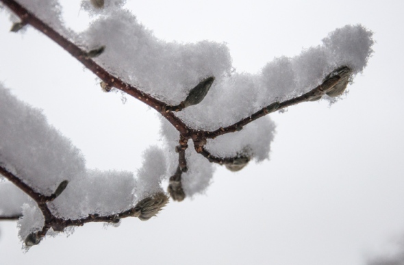
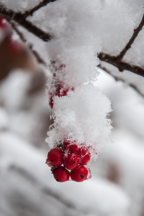
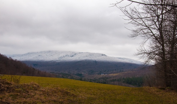
New Year’s Eve, Monday, December 31, 2012
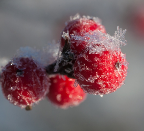
Fine dendritic ice crystals formed on holly berries out by the pond.
Morning Observation:
This morning in Huntington at 7:10AM it’s currently 16 degrees with some lazy snowflakes falling under an overcast sky. Winds are calm. Relative humidity is 93%, dewpoint 15, barometric pressure 30.04″ and falling. We picked up a total of 9″ of blower powder during yesterday’s snowfall and picked up a 0.25″ dusting overnight. We have 17.5″ on the ground. 24hr high was 18, low 5.
Forecast:
Low pressure will drag an Arctic cold front through the region tonight. We’ll see cloudy skies with scattered flurries today. Highs will be in the upper 20s with southwest winds around 10 mph. Tonight should be cloudy with a 40% chance of snow showers or possible snow squalls as the front moves through. Lows will be around 15 with southwest winds 10 to 15 mph, becoming westerly and gusting up to 25 mph after midnight.
High pressure will build in New Years Day bringing partly sunny skies. Highs will be around 15 with northwest winds 10 to 15 mph. Tuesday night should be partly cloudy and cold with lows around zero and west winds around 10 mph.
Wednesday’s looking partly sunny with a 30% chance of snow showers. Highs will be around 8 to 14 above with northwest winds around 10 mph. Wednesday night should be partly cloudy and colder still with lows –5 to –10 below zero.
Almanac:
Last year on this date we had a high of 35 and a low of 26. We picked up 0.25″ of new snow and had 6″ on the ground.
Burlington norms for this date are highs of 29°F and lows of 13°F.
Record high was 56°F in 1965.
Record low was -19°F in 1963.
Sky Notes:
Sunrise: 7:27 AM EST
Sunset: 4:22 PM EST
Length Of Visible Light: 10h 01m
Length of Day: 8h 55m
Tomorrow will be 0m 50s longer.
The Moon is waning gibbous, 18d 3h old with 91% illumination.
Moonrise: 7:59 PM EST
Moonset: 9:00 AM EST
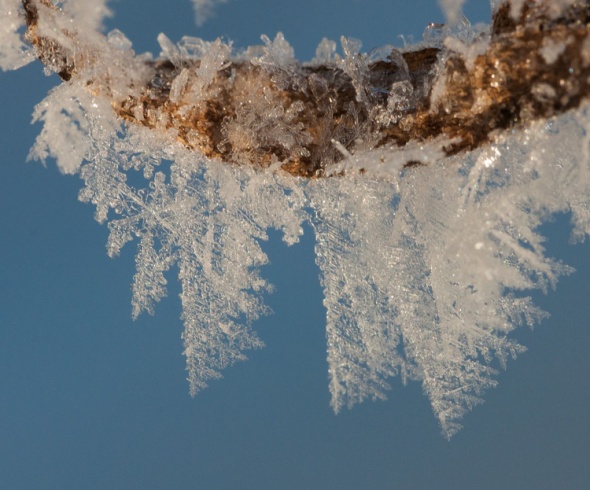
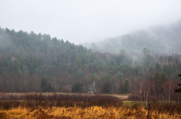
Sunday, December 30, 2012
Snow, frost and ice on Fargo Brook
Morning Observation:
This morning in Huntington at 8:45AM it’s currently 15 degrees and snowing moderately under overcast skies. Winds are out of the east at 0-4 mph. Relative humidity is 89%, dewpoint 12, barometric pressure 29.80″ and rising rapidly. We picked up 7″ of blower powder in the past 24hrs and have 18.5″ on the ground. 24hr high was 26, low 13.
Forecast:
The coastal low that brought us yesterday’s snow is moving off the coast of Nova Scotia this morning. We’ll see cloudy with wraparound snow likely this morning, then a chance of snow showers this afternoon. Expect additional snow accumulation of a dusting to 1″. Highs will be around 16 with northwest winds 15 to 20 mph with gusts up to 30 mph. Chance of snow is 70%. Tonight should be partly cloudy with lows around 6 above and west winds 10 to 15 mph gusting up to 30 mph.
Monday should be mostly cloudy with highs in the mid 20s and south winds around 10 mph. Monday night should be cloudy with a 50% chance of snow showers with possible snow squalls as an Arctic cold front races in. Snow may be heavy at times. Lows will be around 14 with west winds 10 to 15 mph gusting up to 25 mph.
New Years Day is looking partly sunny with highs around 15 and northwest winds 10 to 15 mph. Tuesday night should be partly cloudy and much colder with lows around –10 below as that Arctic air settles in for a few days.
Almanac:
Last year on this date we had a high of 28 and a low of 0. We had 6.5″ of snow on the ground.
Burlington norms for this date are highs of 29°F an lows of 13°F
Record high was 51°F in 1990.
Record low was -29°F in 1933.
Sky Notes:
Sunrise: 7:27 AM EST
Sunset: 4:22 PM EST
Length Of Visible Light: 10h 00m
Length of Day: 8h 54m
Tomorrow will be 0m 45s longer.
The Moon is waning gibbous, 17d 5h old with 96% illumination.
Moonrise: 6:56 PM EST
Moonset: 8:29 AM EST
Saturday, December 29, 2012

Snow, ice, water and rocks in Fargo Brook.
Morning Observation:
This morning in Huntington at 7:35AM it’s currently 20 degrees under overcast skies. Winds are calm. Relative humidity is 95%, dewpoint 19, barometric pressure 29.97″ and falling. We have 14.25″ of snow on the ground.
There is currently a Winter Weather Advisory in effect for our region from 10:00AM this morning until 1:00PM Sunday.
Forecast:
An upper level trough and a coastal low skirting to our south will bring us more snow today–mainly this afternoon. Snow accumulations through the daylight hours should be light–around 1 to 3 inches. Highs will be in the mid 20s with light and variable winds. Chance of snow is near 100%. Snow will continue into tonight with additional snow accumulation of 3 to 5 inches along the western slopes of the Greens. Lows will dip to around around 12 with light and variable winds, becoming northwesterly around 10 mph after midnight. Chance of snow is near 100%.
Sunday should start out cloudy with snow likely in the morning, then become partly sunny with a chance of snow showers in the afternoon. Total snow accumulations from this storm should be around 4 to 8 inches before the spigot shuts off. Highs will be around 14 with northwest winds 10 to 15 mph and gusting to 30 mph. Chance of snow is 70%. Sunday night should be partly cloudy and chilly with lows around 5 above and west winds 10 to 15 mph gusting up to 25 mph.
Monday should be mostly cloudy and warmer. Highs will be in the mid 20s with south winds around 10 mph. Monday night should be cloudy with a 50% chance of snow showers as an Arctic cold from approaches. Lows will be 10 to 15 overnight.
Almanac:
Last year on this date we had a high of 22 and a low of -5. We picked up 9″ of new snow and had 9″ on the ground. Incidentally, this was the single largest snowfall we had the entire 2011-2012 Winter Season.
Burlington norms for this date are highs of 29°F and lows of 13°F.
Record high was 58°F in 1984.
Record low was -29°F in 1933.
Sky Notes:
Sunrise: 7:27 AM EST
Sunset: 4:21 PM EST
Length Of Visible Light: 10h 00m
Length of Day: 8h 53m
Tomorrow will be 0m 41s longer.
Moon is waning gibbous, 16d 4h old with 99% illumination.
Moonrise: 5:55 PM EST
Moonset: 7:55 AM EST
Friday, December 28, 2012
Tiny fine frost crystals cling to a twig along Fargo Brook on a cold morning.
Morning Observation:
This morning in Huntington 6:20AM it’s currently 22 degrees and snowing just a bit under overcast skies. Winds are calm. Relative humidity is 93%, dewpoint 21, barometric pressure 29.94″. We picked up a total of 15.75″ of new snow from the storm (13.50″ yesterday and 2.25″ this morning…) and have 16″ on the ground. 24hr high was 26, low 20.
Forecast:
The powerful low pressure system that dumped on us yesterday is currently moving off the coast of Nova Scotia. We’ll see a little bit of wraparound moisture today with snow showers likely, mainly this morning with additional snow accumulation of 1 to 3 inches. Highs will be in the mid 20s with northwest winds 10 to 15 mph. Chance of snow is 70%. Tonight should be mostly cloudy until midnight, then becoming partly cloudy as weak high pressure builds in. Chance of snow showers is 20%. Lows will be around 7 above with light and variable winds.
Saturday should be cloudy with snow likely mainly in the afternoon as another low passes just to our south and clips us just a bit. Highs will be in the mid 20s with light and variable winds. Chance of snow is 70%. Snow will continue into Saturday night with lows around 13 and northwest winds around 10 mph. Chance of snow is 70%. Expect snow accumulations of 2 to 4 inches from this system.
Sunday’s looking mostly cloudy with a 50% chance of snow showers. Highs will be around 19 with northwest winds 10 to 15 mph and gusting up to 25 mph. Sunday night should be partly cloudy with lows around 5 above.
Almanac:
Last year on this date we had a high of 46 and a low of 11. We picked up 0.50″ of rain and had 1″ of snow on the ground (liking this winter better already…)
Burlington norms for this date are highs of 29°F and lows of 13°F.
Record high was 57°F in 1982.
Record low was -16°F in 1933.
Sky Notes:
Sunrise: 7:27 AM EST
Sunset: 4:20 PM EST
Length Of Visible Light: 9h 59m
Length of Day: 8h 53m
Tomorrow will be 0m 36s longer.
The Moon is the full “Cold” moon (Northeast Native American, Celtic), 15d, 2h old with 100% illumination.
Moonrise: 4:56 PM EST
Moonset: 7:17 AM EST
Other names for this full moon include: “Christmas” (Colonial American, Medieval Wiccan), “Oak” (English), and “Long Night” (Neo Pagan Wiccan).
Thursday, December 27, 2012

Frosted trees catch the morning sunlight along Fargo Brook yesterday morning.
Morning Observation:
This morning in Huntington at 6:35AM it’s currently 25 degrees and snowing lightly under overcast skies. Winds are out of the southwest at 0-3 mph. Relative humidity is 93%, dewpoint 24, barometric pressure 29.72″ and falling rapidly. We picked up 4.5″ of creamy powder overnight and have 8.25″ on the ground. 24hr high was (is) 25, low 2.
A Winter Storm Warning remains in effect for our region until 7:00AM Friday morning. Stay safe out there driving today…
Forecast:
The nor’easter is upon us! Deepening low pressure is moving over the region. We’ll see snow– heavy at times– throughout the day with additional snow accumulation of 6 to 10 inches. Highs will be in the upper 20s with north winds 10 to 15 mph. Chance of snow is near 100%. Snow will continue into tonight with additional accumulations of 1 to 3 inches. Lows will be around 19 with north winds 10 to 15 mph. Chance of snow is near 100%.
Wraparound snow will continue into Friday with additional accumulations of 2 to 4 inches possible. Highs will be in the mid 20s with northwest winds 10 to 15 mph and gusting up to 25 mph. Chance of snow is 70%. Friday night should be cloudy with a 40% chance of snow showers. Lows will be around 10 with west winds around 10 mph.
Saturday’s looking cloudy with a 40% chance of snow. Highs will be in the mid 20s with light and variable winds. Saturday night should be cloudy with a 40% chance of snow and lows around 10 above.
Almanac:
Last year on this date we had a high of 43 and a low of 31. We had 4″ of snow on the ground.
Burlington norms for this date are highs of 30°F and lows of 14°F.
Record high was 55°F in 1949.
Record low was -23°F in 1968.
Sky Notes:
Sunrise: 7:27 AM EST
Sunset: 4:19 PM EST
Length Of Visible Light: 9h 59m
Length of Day: 8h 52m
Tomorrow will be 0m 32s longer.
The Moon is waxing gibbous, 14d 3h old with 99% illumination.
Moonrise: 4:01 PM EST
Moonset: 6:34 AM EST
Wednesday, December 26, 2012
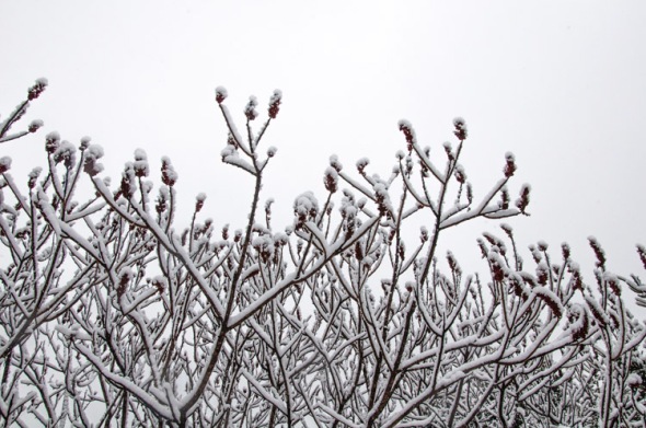
Snowy sumac in the front field
Morning Observation:
This morning in Huntington at 7:15AM it’s currently a chilly 2 degrees under clear skies. Winds are calm. Relative humidity is 89%, dewpoint zero, barometric pressure 30.39″. We picked up 1.25″ of new snow in the past 24hrs and have 4.25″ on the ground. 24hr high was 23, low 2.
There is currently a Winter Storm Warning in effect for our region from 7:00PM tonight until 7:00AM Friday. We got us a nor’easter on the way folks!
Forecast:
High pressure currently over the region will deliver a partly sunny day today with highs in the upper 20s and light and variable winds. The nor’easter will begin to affect the region Tonight as snow will commence after midnight and continue into Friday morning. Snow may be heavy at times after midnight with accumulations of 2 to 4 inches before morning. Lows will be in the lower 20s with light and variable winds, becoming northeast around 10 mph after midnight. Chance of snow is near 100%.
Snow will continue through Thursday coming down heavy at times with additional accumulations of 4 to 8 inches during the day. Highs will be around 30 with northeast winds around 10 mph and gusting up to 25 mph. Chance of snow is near 100%. Snow will beging to taper off Thursday night with additional moderate accumulations. Lows around 19. North winds around 10 mph. Chance of snow near 100 percent.
Wraparound snow will continue into Friday with additional light snow accumulation possible. Expect anywhere from 10″-15″ to fall before all is said & done. Highs Friday will be in the upper 20s with northwest winds around 10 mph. Chance of snow is 70%. Friday night should be cloudy with lows around 10 above.
Almanac:
Last year on this date we had a high of 32 and a low of 16. We picked up 2″ of snow and had 4.5″ on the ground.
Burlington norms for this date are highs of 30°F and lows of 14°F.
Record high was 58°F in 1982.
Record low was -26°F in 1980.
Sky Notes:
Sunrise: 7:26 AM EST
Sunset: 4:18 PM EST
Length Of Visible Light; 9h 58m
Length of Day: 8h 52m
Tomorrow will be 0m 27s longer.
The Moon is waxing gibbous (did anyone see it tucking in close to Jupiter last night?) 13d, 3h old with 97% illumination.
Moonrise: 3:11 PM EST
Moonset: 5:46 AM EST
Christmas Day, Tuesday, December 25, 2012
Fresh snow piles up on magnolia twigs and buds out by our back deck.
Merry Christmas!
Morning Observation:
This morning in Huntington at 8:00AM it’s currently 18 degrees and snowing lightly under overcast skies. Winds are calm. Relative humidity is 93%, dewpoint 17, barometric pressure 30.11″ and rising rapidly. We’ve picked up just a trace of new snow overnight and have 4.5″ on the ground. 24hr high was 29, low 10.
There is currently a Winter Storm Watch in effect for our region from Wednesday evening until Friday morning.
Forecast:
A weak upper level trough moving through the region today will bring us cloudy skies with a chance of light snow mainly this morning. Highs will be in the mid 20s with light and variable winds. Chance of snow is 50%. Tonight should be partly cloudy as brief high pressure builds in. Lows will around 9 above and light and variable winds.
Wednesday will start out partly sunny with highs in the upper 20s and light and variable winds. The aforementioned nor’easter will pull in Wednesday night bringing snow which may be heavy at times. Expect moderate snow accumulation overnight (4″-6″) with lows in the lower 20s and east winds around 10 mph. Chance of snow is 90%.
Snow will persist into Thursday and may be heavy at times. Expect accumulations on the order of 8″-13″ before it’s all done with higher localized amounts in higher elevations along the spine of the Greens. Highs will be in the lower 30s with northeast winds around 10 mph. Chance of snow is near 100%. Thursday night will bring light snow with lows around 20. Chance of snow is 90%.
One caveat to this rosy snow picture is that there’s slight disagreement between some of the forecast models. If the storm tracks further west, then we might get in to warmer air than desired which would impact our snow totals. Stay tuned!
Almanac:
Last year on this date we had a high of 32 and a low of 2. We had 3″ of snow on the ground.
Burlington norms for this date are highs of 30°F and lows of 15°F.
Record high was 62°F in 1964.
Record low was -25°F in 1980.
Sky Notes:
Sunrise: 7:26 AM EST
Sunset: 4:18 PM EST
Length Of Visible Light: 9h 58m
Length of Day: 8h 51m
Tomorrow will be 0m 22s longer.
The Moon is waxing gibbous, 12d 4h old with 93% illumination.
Moonrise: 2:25 PM EST
Moonset: 4:54 AM EST
Monday, December 24, 2012

Light snow piles atop the dried hydrangea blooms next to the back patio–the same hydrangea where many summer bugs love to congregate…
Morning Observation:
This morning in Huntington at 9:55AM it’s currently 20 degrees and snowing lightly under a thin overcast sky. Winds are calm. Relative humidity is 92%, dewpoint 18, barometric pressure 30.09″ and rising rapidly. We picked up 3.25″ of fluffy new snow in the past 24hrs and have 5.5″ on the ground. 24hr high was 30, overnight low got down to 7.
Forecast:
A brief ridge of high pressure is currently building into the region. This will be quickly replaced by a surface low later tonight. Expect cloudy skies with a chance of flurries today with highs in the lower 20s and light and variable winds. Tonight should be partly cloudy until midnight, then mostly cloudy with a chance of light snow after midnight. Lows will be around 14 with light and variable winds. Chance of snow is 50%.
Christmas Day should be cloudy with a chance of light snow in the morning, then partly sunny in the afternoon. Highs will be in the mid 20s with light and variable wind, becoming northerly around 10 mph in the afternoon. Chance of snow is 50%. Tuesday night should be partly cloudy and chilly with lows around 7 above and light and variable winds.
Wednesday’s looking partly sunny with highs in the upper 20s and light and variable winds. A powerful nor’easter will swing up the coast Wednesday night into Thursday bringing widespread snow to the region. It’s looking pretty good for a decent dump here, but we’ll have to wait and see how the storm tracks as to how the temperatures will play out. The “R” word is pretty much out of the picture, but there may be some sleet mixed in at lower elevations. Nonetheless, this is lookin’ good as snow will linger into Friday as well. Stay tuned!
Almanac:
Last year on this date we had a high of 17 and a low of 1. We picked up 2″ of snow and had 3″ on the ground.
Burlington norms for this date are highs of 30°F and lows of 15°F.
Record high was 51°F in 1941.
Record low was -18°F in 1989.
Sky Notes:
Sunrise: 7:26 AM EST
Sunset: 4:17 PM EST
Length Of Visible Light: 9h 58m
Length of Day: 8h 51m
Tomorrow will be 0m 18s longer.
Moon is waxing gibbous, 11d 6h old with 88% illumination.
Moonrise: 1:45 PM EST
Moonset: 3:58 AM EST
Sunday, December 23, 2012
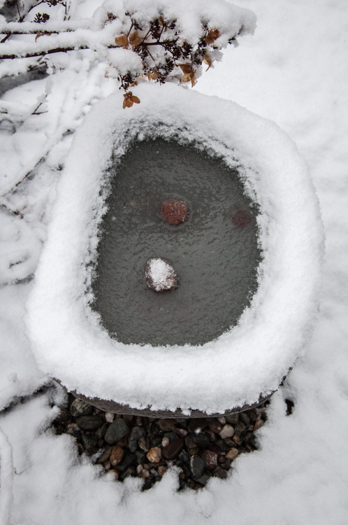
A stone bird bath on our back patio bedecked with snow.
Morning Observation:
This morning in Huntington at 8:40AM it’s currently 20 degrees under partly cloudy skies. Winds are calm. Relative humidity is 82%, dewpoint 15, barometric pressure 29.81″. We picked up 3″ of light snow in the past 24hrs and have 4″ on the ground. 24hr high was 36, low 15.
Forecast:
This morning’s partly cloudy skies will give way to clouds and scattered snow showers, mainly this afternoon, as a weak upper level trough moves in from the Great Lakes. Highs will be in the lower 20s with west winds around 10 mph. Chance of snow is 50%. Skies will remain cloudy until midnight, then become partly cloudy with scattered snow showers. Lows will be around 10 above with light and variable winds. Chance of snow is 50%. Expect little on no additional accumulation.
Monday should be partly sunny as high pressure builds in briefly. Highs will be in the mid 20s with light and variable winds. Monday Night should be mostly cloudy in advance of low pressure. Lows will be around 13 with light and variable winds.
Christmas Day should be partly sunny with a 40% chance of light snow. Highs will be in the mid 20s with light and variable winds. Tuesday night should be mostly clear with lows around 10 above.
Almanac:
Last year on this date we had a high of 31°F and lows of 15°F.
Record high was 58°F in 1990.
Record low was -18°F in 1955.
Sky Notes:
Sunrise: 7:25 AM EST
Sunset: 4:17 PM EST
Length Of Visible Light: 9h 57m
Length of Day: 8h 51m
Tomorrow will be 0m 13s longer.
The Moon is waxing gibbous, 10d 5h old with 81% illumination.
Moonrise: 1:10 PM EST
Moonset: 3:00 AM EST
Saturday, December 22, 2012
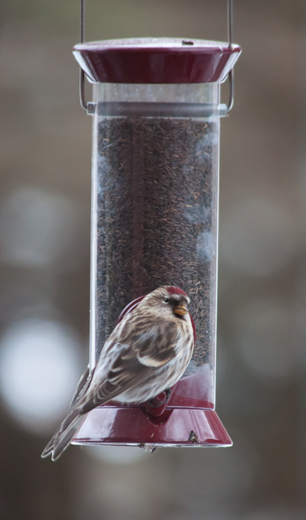
A redpole at our thistle feeder. There are a lot of these little birds about this season arriving in great busy flocks.
Morning Observation:
This morning in Huntington at 7:15AM it’s currently 31 degrees and snowing lightly under overcast skies. Winds are calm. Relative humidity is 90%, dewpoint 28, barometric pressure 29.23″ and rising rapidly. We picked up 0.83″ of rain in the past 24hrs and 1.25″ of snow. Or top wind speed here in our sheltered hollow was 43 mph—tying our record. 24hr high was 47, low 31.
There is currently a Winter Weather Advisory in effect for our region from 7:00AM this morning until 7:00AM Sunday. The advisory calls for snow accumulations of 3-7″ along the western slopes of the Greens with higher amounts locally from Stowe to Jay Peak(!)
Forecast:
As yesterday’s low departs we’ll see a good shot of wraparound moisture in form of snow today. Snow accumulations should be in the range of 2″ to 4″. Highs will be in the lower 30s, falling into the mid 20s this afternoon. West winds will blow 10 to 15 mph with gusts up to 30 mph this afternoon. Chance of snow is 80%. Tonight should be mostly cloudy with snow showers likely until midnight, then partly cloudy with a chance of snow showers after midnight. Total snow accumulation of 3″ to 5″ with higher totals the further north you go. Lows will be much colder–around 9 above–with west winds 15 to 20 mph and gusting up to 30 mph. Chance of snow is 70%.
Sunday should be partly sunny as high pressure builds in. Highs will be in the lower 20s with west winds around 10 mph. Sunday Night should be partly cloudy with lows around 9 above and light and variable winds.
Christmas Eve is looking partly sunny with highs in the lower 20s and southwest winds around 10 mph. Monday night should be partly cloudy with lows around 10 above.
Almanac:
Last year on this date we had a high of 46 and a low of 36. We picked up 0.46″ of rain.
Burlington norms for this date are highs of 31°F and lows of 16 °F
Record high was 57°F in 1990.
Record low was -20°F in 1955.
Sky Notes:
Sunrise: 7:25 AM EST
Sunset: 4:16 PM EST
Length Of Visible Light: 9h 57m
Length of Day: 8h 51m
Tomorrow will be 0m 8s longer.
The Moon is waxing gibbous, 9d 3h old with 72% illumination.
Moonrise: 12:38 PM EST
Moonset: 2:00 AM EST
We lost power yesterday morning at around 8:00AM and are still without it (except for our generator thankfully…) One of our higher elevation south-facing neighbors reported winds in the 70s, and there are many trees down around town. Oh, and the roof was peeled off the the Pecor’s house next to Beaudy’s store. A tree fell by our next door neighbor’s house, clipping the corner of their house and taking down the power lines that cross their back yard and our side field and pond. Currently the power lines are taking a swim… So, it looks like we may be waiting for power for a while. Quite the day and reminiscent of the December 1, 2010 blow. I think not as many trees came down this time just because so many came down that day…
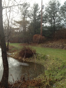
Our power lines in the pond…
Friday, December 21, 2012
Holly berries with a dusting of snow the other day out by the pond.
Happy Winter Solstice!
Morning Observation:
This morning in Huntington at 7:00AM it’s currently a blowy 39 degrees under overcast skies. Winds are out of the south gusting up to 22 mph this morning. Relative humidity is 84%, dewpoint 34, barometric pressure 29.42″ and falling rapidly. We picked up 0.5″ of slushy snow overnight and have 3″ of snow on the ground. 24hr high was (is) 39, low 33.
There is currently a High Winds Warning in effect for our region until 7:00PM tonight.
Forecast:
With a powerful low pressure system just about right over us this morning, we’ll have an active and blustery day! We’ll see rain or sleet this morning, then rain this afternoon. Expect little or no sleet accumulation. Highs will be in the lower 40s with southeast winds 20 to 25 mph gusting up to 60 mph along the western slopes of the Greens. Chance of precipitation is 90%. Tonight should be cloudy with a chance of rain until midnight, then a chance of rain or snow showers after midnight. Lows will be in the upper 20s with south winds 10 to 15 mph. Chance of precipitation is 50%.
Saturday should be cloudy with wraparound snow or rain showers likely, mainly in the afternoon. Expect snow accumulation a dusting to 2″ possible. Highs will be in the mid 30s with south winds around 10 mph, becoming westerly in the afternoon. Chance of precipitation is 70%. Saturday night snow showers are likely with additional light snow accumulation possible. It will be noticeably colder with lows around 13 and northwest winds 10 to 15 mph gusting up to 30 mph. Chance of snow is 70%.
Sunday’s looking partly sunny with a 50% chance of snow showers. Highs will be in the lower 20s with northwest winds 10 to 15 mph. Sunday night should be partly cloudy with lows around 5 above.
Almanac:
Last year on this date we had a high of 48 and a low of 17.
Burlington norms for this date are highs of 31°F and lows of 16°F.
Record high was 61°F in 1957.
Record low was -22°F in 1955.
Sky Notes:
Sunrise: 7:24 AM EST
Sunset: 4:15 PM EST
Length Of Visible Light: 9h 57m
Length of Day: 8h 51m
Tomorrow will be 0m 3s longer.
The Moon is waxing gibbous, 8d 3h old with 63% illumination.
Moonrise: 12:10 PM EST
Moonset: 12:59 AM EST
Today is the Winter Solstice! It occurred this morning at 6:12AM. This is the moment when the earth’s northern pole is inclined the furthest from the sun in our orbit around the sun. It marks the shortest day of the year and the astronomical beginning of winter in the norther hemisphere. From today until the Summer Solstice, the days will begin to get longer (3 seconds longer tomorrow!) as the light returns! Happy Solstice!
Thursday, December 20, 2012
Snow-laden ash branches resemble a deer’s velveted antlers yesterday morning…
Morning Observation:
This morning in Huntington at 8:05AM it’s currently 30 degrees under overcast skies. Winds are calm. Relative humidity is 94%, dewpoint 28,barometric pressure 30.21″ and rising. We picked up 0.03″ of melted precip and 0.75″ of crusty snow in the past 24hrs. We have 2″ of snow on the ground. 24hr high was 36, low 29.
There is currently a High Wind Watch in effect for our region from late tonight into Friday evening.
Forecast:
A brief shot of weak high pressure will move through the region today. We’ll see mostly cloudy skies this morning partly sunny skies this afternoon. Highs will be in the mid 30s with light and variable winds. Tonight should be cloudy with snow or rain likely or a chance of sleet after midnight as a powerful low pressure system currently centered out over the western Great Lakes moves in. Snow and sleet accumulations may reach a dusting to 1 inch. Overnight lows in the upper 20s with southeast winds 15 to 20 mph and increasing overnight. Chance of precipitation is 70%.
The storm will on us Friday bringing rain or snow in the morning, then rain in the afternoon as warm air advection raises temperatures region wide. Expect snow accumulation a dusting to 1″ before changing over to all rain. Highs will be in the lower 40s. The main threat of this storm will be strong and damaging winds. We’ll see southeast winds 25 to 35 mph with gusts up to 55 mph along the western slopes of the Greens. Some power outages may occur so be prepared. Chance of precipitation is 90%. Friday night should bring light rain or a chance of light snow as the storm departs to our east and cooler air moves in behind it. Expect little or no additional snow accumulation. Lows will be around 30 with south winds 10 to 15 mph. Chance of precipitation is 70%.
Saturday’s looking cloudy with a 50% chance of snow showers. Highs will be in the mid 30s with southwest winds 10 to 15 mph. Saturday night should be cloudy with a 50% chance of snow showers and lows around 15.
Almanac:
Last year on this date we had a high of 34 and a low of 15. We picked up 0.05″ of rain and had no snow on the ground.
Burlington norms for this date are highs of 32°F and lows of 17°F.
Record high was 62°F in 1957.
Record low was -23°F in 1942.
Sky Notes:
Sunrise: 7:24 AM EST
Sunset: 4:15 PM EST
Length Of Visible Light: 9h 57m
Length of Day: 8h 51m
Tomorrow will be 0m 1s shorter.
The Moon is in its first quarter, 7d 4h old with 53% illumination.
Moonrise: 11:43 AM EST
No Moon Set
Today is the last day of Fall as tomorrow brings the Winter Solstice at 6:12AM. Hopefully things will get a little more wintery around here…
Wednesday, December 19, 2012

A lone cattail in the wetland along Taft Road.
Morning Observation:
This morning in Huntington at 6:50AM it’s currently 33 degrees and snowing lightly under overcast skies. Winds are calm. Relative humidity is 98%, dewpoint 32, barometric pressure 29.65″ and rising rapidly. We picked up 0.38″ of rain in the past 24hrs and 1.25″ of fairly dense snow. 24hr high was 42, low 33.
Forecast:
A ridge of high pressure is currently building into the region and will help to push out the low that produced the rain and snow of the past couple of days. We’ll see patchy fog this morning and cloudy skies with a chance of snow or rain showers during the day. Highs will be in the upper 30s with northwest winds 10 to 15 mph gusting up to 25 mph. Chance of precipitation is 50%. Tonight should be cloudy with a chance of snow showers, mainly until midnight. Lows will be in the upper 20s with northwest winds 10 to 15 mph. Chance of snow is 40% overnight with little or no accumulation.
Thursday should start out partly sunny before the next, more powerful storm system pulls in. Highs will be in the mid 30s with light and variable winds, becoming easterly around 10 mph in the afternoon. Thursday night will be cloudy with a chance of rain. Winds will begin to pick up late as the storm approaches from the west. Temperatures will remain near steady in the mid 30s perhaps rising a bit overnight. We’ll see southeast winds 15 to 25 mph with gusts up to 45 mph. Chance of rain is 50%.
The storm will be upon us Friday bringing rain and winds with highs in the upper 30s and southeast winds 20 to 30 mph with gusts up to 45 mph. Chance of rain is 90%. Friday night snow or rain showers likely with light snow accumulation possible as cooler air moves in behind the storm. Lows will be in the mid 20s. Chance of precipitation is 60%.
Almanac:
Last year on this date we had a high of 40 and a low of 8. We had 1″ of snow on the ground.
Burlington norms for this date are highs of 32°F and lows of 17°F.
Record high was 49°F in 1895.
Record low was -16°F in 1942.
Sky Notes:
Sunrise: 7:23 AM EST
Sunset: 4:14 PM EST
Length Of Visible Light: 9h 57m
Length of Day: 8h 51m
Tomorrow will be 0m 6s shorter.
The Moon is a waxing crescent, 6d 3h old with 43% illumination.
Moonrise: 11:16 AM EST
Moonset: 11:56 PM EST
Tuesday, December 18, 2012
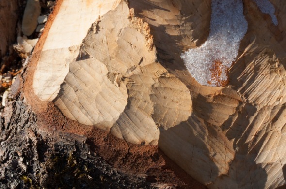
A recently felled birch tree at a beaver pond along Taft Road shows beaver chew marks and a crusting of frozen sap.
Morning Observation:
This morning in Huntington at 6:30AM it’s currently 36 degrees and raining under overcast skies. Winds are calm. Relative humidity is 97%, dewpoint 35, barometric pressure 29.59″ and falling rapidly. We picked up 0.36″ of rain overnight. Our scant layer of crusty snow is gone. 24hr high was 40, low 36.
Morning radar imagery shows a large slug of precipitation–mostly rain with areas of mixed over the ‘Dacks and eastern VT–moving north and rotating up the coast and over New England from the eastern Great Lakes into southern Maine.
There is currently a Winter Weather Advisory in effect for our region until 10:00AM this morning. It’s calling for pockets mixed precipitation of snow and freezing rain over the higher mountain elevations of the ‘Dacks and the Green Mountains eastward. The Champlain Valley is not in the warning area.
Forecast:
Low pressure and its associated warm front will lift through the region in a northeasterly direction today. We’ll see pockets of snow and freezing rain this morning over higher elevations of the ‘Dacks, northern Greens and eastern Vermont before warm air scours out the cold. Precipitation should change over to all rain later in the day, but not before coating some of the aforementioned areas with some icing and an inch or so of snow. Highs will reach in the upper 30s and low 40s during the day with light and variable winds. Chance of precipitation is near 100%. Rain will continue into tonight with snow or rain showers likely after midnight as temps drop on the backside of this current system. Additional snow accumulation a dusting to 1″ are possible. Lows will be around 30 with light and variable winds. Chance of precipitation is 80%.
Weak high pressure should build in Wednesday bringing cloudy skies with a chance of snow or rain showers. Highs will remain above seasonable norms– in the mid 30s– with northwest winds around 10 mph. Chance of precipitation is 50%. Wednesday night should be mostly cloudy with lows in the lower 20s and light and variable winds.
Thursday’s looking mostly cloudy with highs around 40 and light and variable winds. Another strong storm system moves into the region Thursday night bringing cloudy skies, strong wind and a chance of snow or rain showers overnight. Overnight lows should be seasonable–upper 20s to lower 30s. Chance of precipitation is 50%. Temperatures will rise into Friday morning however…
Almanac:
Last year on this date we had a high of 22 and a low zero. We had 1″ of snow on the ground.
Burlington norms for this date are highs of 32°F and lows of 17°F.
Record high was 57°F in 1921.
Record low was -13°F in 1919.
Sky Notes:
Sunrise: 7:23 AM EST
Sunset: 4:14 PM EST
Length Of Visible Light: 9h 58m
Length of Day: 8h 51m
Tomorrow will be 0m 11s shorter.
The Moon is a waxing crescent, 5d 3h old with 32% illumination.
Moonrise: 10:49 AM EST
Moonset: 10:51 PM EST
Monday, December 17, 2012

Twists of birch bark peeling from a trunk…
Morning Observation:
This morning in Huntington at 6:15AM it’s currently 32 degrees under overcast skies. We’ve got a mix of sleet and frozen rain coming down, and have a 1″ layer of the stuff stuck to the ground. Relative humidity is 88%, dewpoint 29, barometric pressure 29.94″ and falling. 24hr high was 36, low 31. It’s messy out there folks, so be very careful if you need to drive anywhere this morning.
There is currently a Winter Weather Advisory in effect for our region through 1:00PM this afternoon.
Forecast:
Low pressure responsible for this morning’s mix o’ messy is currently moving to our east. We’ll continue to see snow or sleet or rain this morning, then sleet or rain this afternoon as temperatures remain above freezing and climb a bit through the day. Total snow/sleet accumulations are on the order of 1″-3″. Highs today will be in the mid 30s with southeast winds 10 to 15 mph gusting up to 25 mph. Chance of precipitation is near 100%. Tonight will be cloudy with a chance of rain or sleet until midnight, then rain likely after midnight as the next low pressure system in the pipeline moves into the region overnight. Expect little or no additional sleet accumulation. Temperatures will reamin near steady in the lower 30s overnight with southeast winds around 10 mph. Chance of precipitation is 70%.
This moisture-laden low will be firmly in place Tuesday and will deliver rain and warmer temperatures. Highs will be in the upper 30s to lower 40s south with east winds around 10 mph in the morning, becoming light and variable. Chance of rain is 90%. Rain will persist into Tuesday night with snow showers likely as cooler temps move in on the backside of the low as it heads east. Expect light snow accumulation. Lows will be in the upper 20s with northwest winds around 10 mph. Chance of precipitation is 80%.
Wednesday’s looking cloudy with a chance of rain or snow showers as a brief break of high pressure builds in. Highs will be in the mid 30s with northwest winds 10 to 15 mph. Chance of precipitation is 50%. Wednesday night should be partly cloudy with lows in the mid 20s.
As mentioned yesterday, another strong weather maker moves into the region Thursday night into Friday, and I’m afraid it’s looking damp…
Almanac:
Last year on this date we had a high of 30 and a low of 5. We picked up 0.01″ of rain and 1.25″ of snow, and had 1.25″ of snow on the ground.
Burlington norms for this date are highs of 33°F and lows of 18°F.
Record high was 56°F in 2000 (we had a high of 54).
Record low was -10°F in 1919.
Sky Notes:
Sunrise: 7:22 AM EST
Sunset: 4:14 PM EST
Length Of Visible Light: 9h 58m
Length of Day: 8h 51m
Tomorrow will be 0m 15s shorter.
The Moon is a waxing crescent, 4d 3h old with 22% illumination.
Moonrise: 10:20 AM EST
Moonset: 9:43 PM EST
Sunday, December 16, 2012

Dappled sunlight paints the rocks and pebbles on the bed of Fargo Brook yesterday.
Morning Observation:
This morning in Huntington at 9:00AM it’s currently 28 degrees under overcast skies. Winds are calm. Relative humidity is 89%, dewpoint 25, barometric pressure 30.18″ and dropping. 24hr high was 32, low 14.
There is currently a Winter Weather Advisory in effect for our region from 10:00AM this morning until 1:00PM Monday.
Forecast:
We’re in for some messy weather over the next few days as we deal with a warm front and associated low pressure center that will move through the region over the next couple of days. We’ll see cloudy skies with a 50% chance of snow during the day. Highs will be in the lower 30s with southeast winds 10 to 15 mph. Tonight more warm air will move into the region. Transitional precipitation types will be likely until midnight, changing over to all rain after midnight. Snow and sleet accumulations will be on the light side as there’s not all that much moisture in this system to work with. Expect a dusting to 1″ over higher terrain with little or no accumulation in the Champlain Valley. Temperature will remain steady around 30 with southeast winds 10 to 15 mph gusting up to 30 mph. Chance of precipitation is 70%.
Monday will be cloudy with a chance of rain and sleet in the morning. Highs will continue to rise into the upper 30s and low 40s with southeast winds 10 to 15 mph gusting up to 30 mph in the morning. Chance of precipitation is 60%. Rain will continue into Monday night with steady temperature in the mid 30s and east winds around 10 mph. Chance of rain is 70%.
The a second low pressure system will move through the region Tuesday bring more rain (sorry…) Highs will be in the upper 30s with north winds 15 to 20 mph. Chance of rain is 90%. Tuesday night rain showers are likely or a chance of snow showers as temps drop on the backside of the low. Expect little or no snow accumulation. Lows will be in the lower 30s. Chance of precipitation is 70%.
Another storm system will swing into our region Thursday into Friday. Unfortunately, at this time it’s looking warm and wet as well…
Almanac:
Last year on this date we had a high of 49 and a low of 41. We picked up 0.43″ of rain which took care of any snow on the ground.
Burlington norms for this date are highs of 33°F and lows of 18°F.
Record high was 54°F in 1982.
Record low was -18°F in 1917.
Sky Notes:
Sunrise: 7:21 AM EST
Sunset: 4:13 PM EST
Length Of Visible Light: 9h 58m
Length of Day: 8h 51m
Tomorrow will be 0m 20s shorter.
The Moon is a waxing crescent, 3d 5h old with 15% illumination.
Moonrise: 9:47 AM EST
Moonset: 8:32 PM EST
Anyone see the ISS yesterday evening? It came over right at 4:57PM–right past the lovely crescent moon. There’s another flyby at 5:44PM this evening, but there will certainly be clouds in the way.
Saturday, December 15, 2012

Spiky ice crystals form on a curled leaf down along Fargo Brook.
Morning Observation:
This morning in Huntington at 8:55AM it’s currently 20 degrees under clear skies. Winds are calm. Relative humidity is 86%, dewpoint 15, barometric pressure 30.38″ and rising. 24hr high was 38, low 20.
Forecast:
Cool Canadian high pressure will deliver what may be the last clear day in for a while today. We’ll see clear skies today with highs making it up only into the mid 20 with north winds 10 to 15 mph. Tonight will be partly cloudy until midnight, then it’ll become mostly cloudy out ahead of the next weather-maker. Lows will be around 16 with light and variable winds, becoming southeasterly around 10 mph after midnight.
A warm front will push into the region from the south and west Sunday bring cloudy. Snow is likely, mainly in the afternoon with accumulations of a dusting to 2″ possible. Highs will be in the lower 30s with southeast winds around 10 mph. Chance of snow is 70%. Sunday night snow or sleet are possible as regional temps continue to rise. Additional light snow accumulations are possible. Near steady temperature will be in the upper 20s with southeast winds 10 to 15 mph gusting up to 25 mph. Chance of precipitation is 90%.
Monday should bring sleet or rain as the last of the cold air is scoured out. Expect little or no additional sleet accumulation as the precipitation should turn over to all rain by mid-day in the Champlain Valley and areas west of the Greens. Highs will be in the mid 30s with southeast winds 15 to 20 mph. Chance of precipitation is 90%. Monday night a chance of snow or rain are likely with little or no snow accumulation. Lows will be in the mid 30s. Chance of precipitation is 70%.
More unsettled weather is expected through next week as two more systems move into the region Tuesday and Friday. At this point, the early storm is looking wet while the later storm might lean towards snow. Stay tuned…
Almanac:
Last year on this date we had a high of 49 and a low of 39. We picked up 0.10″ of rain and had 1″ of snow on the ground.
Burlington norms for this date are highs of 33°F and lows of 19°F.
Record high was 62°F in 1901.
Record low was -12°F in 1943.
Sky Notes:
Sunrise: 7:21 AM EST
Sunset: 4:13 PM EST
Length Of Visible Light: 9h 58m
Length of Day: 8h 52m
Tomorrow will be 0m 25s shorter.
The Moon is a waxing crescent, 2d 5h old with 7% illumination.
Moonrise: 9:08 AM EST
Moonset: 7:19 PM EST
Want to catch a glimpse of the International Space Station (ISS)? It’ll be passing overhead this evening at 4:57PM and will be visible for 4 minutes. Look for it in SSW sky heading in a ENE direction. It’ll be the brightest thing out there and you won’t be able to miss it!
Friday, December 14, 2012
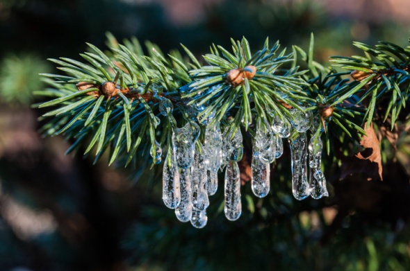
Tiny icicles form on the needles of a dwarf spruce as water drips off the eaves of our front porch.
Morning Observation:
This morning in Huntington at 6:55AM it’s currently 33 degrees under mostly clear skies. Winds are calm. Relative humidity is 74%, dewpoint 26, barometric pressure 30.13″ and falling slowly. 24hr high was 38, low 29.
Forecast:
We’ll have another unseasonably warm day today with partly sunny skies and highs around 40. Isolated rain showers will move in this afternoon as a cold front drops down from Canada. Winds will be out of the south at around 10 mph, becoming westerly and gusting up to 25 mph this afternoon. Chance of rain is 20%. Tonight should be mostly cloudy with scattered snow showers until midnight, then partly cloudy after midnight. Lows will be around 14 with north winds around 10 mph, gusting up to 25 mph until midnight. Chance of snow is 30%.
Saturday should be sunny and chilly with highs in the mid 20s and light and variable winds. Saturday night should be partly cloudy with lows around 12 and light and variable winds.
A warm front with associated low pressure will move into the region Sunday bringing cloudy skies with a 50% chance of light snow. Highs will be around 30 with southeast winds around 10 mph. Sunday night should bring snow or sleet as the warm air builds in further. Expect little or no snow accumulation. Lows will be in the mid 20s. Chance of precipitation is near 100%.
A more potent low pressure nor’easter is setting up to impact the region Monday night into Tuesday night, but forecast models are bit uncertain as to what we might expect from it. I’m keeping my fingers crossed for some snow! Stay tuned…!
Almanac:
Last year on this date we had a high of 41 and a low of 29. We picked up 0.25″ of snow and had 2″ on the ground.
Burlington norms for this date are highs of 34°F and lows of 19°F.
Record high was 63°F in 1901.
Record low was -11°F in 1933.
Sky Notes:
Sunrise: 7:20 AM EST
Sunset: 4:13 PM EST
Length Of Visible Light: 9h 59m
Length of Day: 8h 52m
Tomorrow will be 0m 29s shorter.
The Moon is a waxing crescent, 1d 3h old with 2% illumination.
Moonrise: 8:20 AM EST
Moonset: 6:05 PM EST
Thursday, December 13, 2012

Leaves on the bottom of our pond create a colorful mosaic under faceted ice.
Morning Observation:
This morning in Huntington at 6:55AM it’s currently 25 degrees under mostly cloudy skies. Winds are calm. Relative humidity is 95%, dewpoint 24, barometric pressure 30.45″ and rising. 24hr high was 35, low 25.
Forecast:
With high pressure in place over the region we’ll continue to see tranquil weather into the weekend. We’ll see mostly cloudy skies this morning, then partly sunny skies later in the day. Highs will be in the mid 30s with light and variable winds. Tonight should be partly cloudy with lows in the mid 20s and light and variable winds.
Friday should be partly sunny and warmer with highs in the upper 30s and south winds around 10 mph, becoming westerly with gusts up to 25 mph in the afternoon. Friday night should be partly cloudy with a 40% chance of snow showers as a cold front dips down from Canada overnight. Lows will be around 18 with northwest winds around 10 mph gusting up to 25 mph.
Saturday’s looking mostly sunny and cooler with highs in the upper 20s and north winds around 10 mph. Saturday night should be partly cloudy with lows around 20.
Almanac:
Last year on this date we had a high of 35 and a low of 18. We had 1.75″ of snow on the ground.
Burlington norms for this date are highs of 34°F and lows of 20°F.
Record high was 56°F in 1946.
Record low was -9°F in 1982.
Sky Notes:
Sunrise: 7:19 AM EST
Sunset: 4:13 PM EST
Length Of Visible Light: 9h 59m
Length of Day: 8h 53m
Tomorrow will be 0m 34s shorter.
The Moon is new, 3 hours old with 0% illumination.
Moonrise: 7:24 AM EST
Moonset: 4:53 PM EST
Don’t forget to take a look outside tonight if the sky is clear (dicey…) as the Geminid meteor showers are peaking tonight. You might see one a minute if you’re lucky…
Wednesday, December 12, 2012
A well-defined rime line down to around 2500′ marks the flanks of Mt. Ira Allen in this view south from Taft Hill yesterday.
Happy 12/12/12!
Morning Observation:
This morning in Huntington at 6:30AM it’s currently a brisk 18 degrees under mostly clear skies. Venus is hanging just above the eastern horizon. Winds are calm. Relative humidity is 94%, dewpoint 17, barometric pressure 30.28″ and rising. 24hr high was 37, low 18.
Forecast:
With high pressure in place over the region, we have a series of dry and seasonably cool days ahead. Today we’ll see partly sunny skies with highs in the lower 30s and light and variable winds. Tonight should be partly cloudy with lows in the lower 20s and light and variable winds.
Thursday should be partly sunny with highs in the mid 30s and light and variable winds. Thursday night should be partly cloudy with lows in the mid 20s and south winds around 10 mph. Keep on eye out for the Geminid meteor showers that peak Thursday night.
Friday’s looking partly sunny and warmer courtesy of a southern air flow. Highs will be around 40 with south winds around 10 mph and gusting up to 25 mph. Friday night should be partly cloudy with lows in the mid 20s.
Almanac:
Last year on this date we had a high of 42 and a low of 20. We had 1.75″ of snow on the ground.
Burlington norms for this date are highs of 34°F and lows of 20°F.
Record high was 59°F in 1899.
Record low was -13°F in 1977.
Sky Notes:
Sunrise: 7:18 AM EST
Sunset: 4:12 PM EST
Length Of Visible Light: 10h 00m
Length of Day: 8h 54m
Tomorrow will be 0m 38s shorter.
The Moon is a waning crescent, 28d 13h old with 1% illumination.
Moonrise: 6:19 AM EST
Moonset: 3:47 PM EST
As already mentioned, the Geminid meteor shower peaks tomorrow night 12/13-14. The Geminids often pack a good bang-for-the-buck with about one per minute rivaling the Perseids of August. The fact that it’s a new moon tomorrow night will add to viewing pleasure! Hopefully the clouds will cooperate!
Tuesday, December 11, 2012
Low clouds make for a moody December morning.
Morning Observation:
This morning in Huntington at 7:45AM it’s currently 27 degrees under overcast skies. Winds are calm. Relative humidity is 91%, dewpoint 25, barometric pressure 29.82″ and rising rapidly. We picked up 0.77″ of rain overnight and just a crust of icing. 24hr high was 53, low 27.
Watch for icy roads out there this morning folks…
Forecast:
High pressure is currently building into the region and will affect our weather for the next few days. We’ll see cloudy skies with isolated snow showers this morning, then partly sunny skies this afternoon. Highs will be in the upper 20s with north winds around 10 mph this morning, becoming light and variable. Chance of snow is 20%. Tonight should be clear and chilly with lows around 13 and light and variable winds.
Wednesday should be sunny in the morning then becoming partly sunny as a weak disturbance tracks to our north. Highs will be in the lower 30s with light and variable winds. Wednesday night should be partly cloudy with lows in the lower 20s and light and variable winds.
Thursday’s looking partly sunny with highs in the mid 30s and south winds around 10 mph. Thursday night should be partly cloudy with lows in the mid 20s.
Almanac:
Last year on this date we had a high of 33 and a low of 12. We had 2″ of snow on the ground.
Burlington norms for this date are highs of 35°F and lows of 21°F.
Record high was 61°F in 1966.
Record low was -13°F in 1958.
Sky Notes:
Sunrise: 7:18 AM EST
Sunset: 4:12 PM EST
Length Of Visible Light: 10h 01m
Length of Day: 8h 54m
Tomorrow will be 0m 43s shorter.
The Moon is waning crescent, 27d 14h old with 5% illumination.
Moonrise: 5:07 AM EST
Moonset: 2:51 PM EST
Monday, December 10, 2012
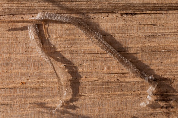
A snake skin curled against a maple log in our woodpile yesterday.
Morning Observation:
This morning in Huntington at 6:30AM it’s currently a blustery 41 degrees and raining under overcast skies. Winds are out of the south at 4-6 mph. Relative humidity is 88%, dewpoint 38, barometric pressure 29.74″ and falling rapidly. We picked up 0.17″ of rain overnight. 24hr high was 42, low 35.
The Winter Weather Advisory mentioned yesterday remains in effect for our area until 7:00AM this morning, however, morning radar imagery is showing mostly rain in the Champlain Valley with areas of more frozen stuff in higher elevations and to the east. The Montpelier area might be getting some mixed precip right about now…
Forecast:
Low pressure is currently moving through the region and will bring rain or freezing rain this morning then rain this afternoon. Highs will be in the lower 40s with south winds around 10 mph. Chance of precipitation is near 100%. Rain showers until midnight with snow showers likely as cooler air moves in on the backside of the low. We might see snow accumulations of a dusting to 2″. Lows will be in the lower 20s with light and variable winds, becoming northwesterly around 10 mph after midnight. Chance of precipitation is 80%.
High pressure will build in Tuesday bringing partly sunny skies in the morning, then clearing. It will be cooler with highs in the upper 20s and northwest winds around 10 mph. Tuesday night should be mostly clear with lows around 12 and light and variable winds.
Wednesday’s looking mostly sunny with highs in the lower 30s and light and variable winds. Wednesday night should be partly cloudy with lows in the lower 20s.
Almanac:
Last year on this date we had a high of 36 and a low of 15. We picked up 0.50″ of snow and had 2″ on the ground.
Burlington norms for this date are highs of 35°F and lows of 21°F.
Record high was 61°F in 1966.
Record low was -9°F in 1958.
Sky Notes:
Sunrise: 7:17 AM EST
Sunset: 4:12 PM EST
Length Of Visible Light: 10h 01m
Length of Day: 8h 55m
Tomorrow will be 0m 48s shorter.
The Moon is a waning crescent, 26d 13h old with 12% illumination.
Moonrise: 3:52 AM EST
Moonset: 2:03 PM EST
Sunday, December 9, 2012
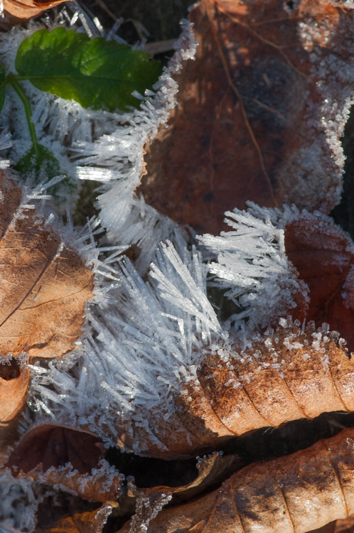
Curled, dry leaves frosted…
Morning Observation:
This morning in Huntington at 8:00AM it’s currently 35 degrees under mostly cloudy skies. Winds are calm. Relative humidity is 89%, dewpoint 32, barometric pressure 30.25″ and rising rapidly. We picked up 0.02″ of rain in the past 24hrs. 24hr high was 45, low 35.
There is currently a Winter Weather advisory in effect for our region from 10:00PM tonight to 7:00AM Monday.
Forecast:
High pressure currently building into the region will deliver as short-lived partly sunny day today. There’s a slight chance of snow showers this morning. Highs will be in the upper 30s with light and variable winds. Chance of snow is 20%. Things will begin to get messy tonight as a low pressure system and associated warm front move into the region from the south carry a fair amount of moisture. We’ll see cloudy skies tonight with a chance of snow until midnight, then sleet or snow likely with the potential for some freezing rain after midnight. Snow and sleet accumulation should be in the range of 1 to 3 inches, with ice accumulation of up to a tenth of an inch. Icing is more likely north of us, but remains a possibility here as well. Lows will be in the upper 20s with light and variable winds, becoming southerly around 10 mph and gusting up to 25 mph after midnight. Chance of precipitation is 90%.
Monday should start out messy with freezing rain in the early morning changing over to all rain late morning as the warm southerly airflow scours out the remaining cold air. The morning commute looks to be a bit sketchy… Highs will be around 40 with south winds around 10 mph gusting up to 25 mph in the morning. Chance of precipitation near 100%. Monday night snow showers are likely as cold air moves in behind the departing warm air mass. Light snow accumulation is possible. Lows will be around 19 with northwest winds around 10 mph. Chance of snow is 70%.
Tuesday’s looking partly sunny as high pressure builds in. Highs will be in the upper 20s with north winds around 10 mph. Tuesday night should be partly cloudy with lows around 20.
Almanac:
Last year on this date we had a high of 38 and a low of 28. We had 3″ of snow on the ground.
Burlington norms for this date are highs of 36°F and lows of 22°F.
Record high was 61°F in 1966.
Record low was -10°F in 1902.
Sky Notes:
Sunrise: 7:16 AM EST
Sunset: 4:12 PM EST
Length Of Visible Light: 10h 02m
Length of Day: 8h 56m
Tomorrow will be 0m 52s shorter.
The Moon is a waning crescent (lovely this morning!)
Moonrise: 2:38 AM EST
Moonset: 1:23 PM EST
Saturday, December 8, 2012

Lichen growing on the rocks of our back patio.
Morning Observation:
This morning in Huntington at 8:10AM it’s currently 33 degrees under overcast skies. Winds are calm. Relative humidity is 97%, dewpoint 32, barometric pressure 29.94″ and falling. 24hr high was 41, low 32.
Morning radar imagery is showing a large slug of rain stretching from Chicago to off the coast of Massachusetts and lifting into our region. We can expect to see rain by 10:00 or 11:00AM here.
Forecast:
Approaching low pressure will deliver a cloudy day with rain likely and a chance of light sleet this morning, then a chance of rain or snow showers this afternoon. Little or no snow and sleet accumulation is expected. Highs will be in the upper 30s with light and variable winds. Chance of precipitation is 60%. Tonight should be cloudy with a chance of rain or snow showers until midnight, then a chance of snow showers after midnight. Lows will be in the upper 20s with south winds around 10 mph, becoming northwesterly after midnight. Chance of precipitation is 40%.
High pressure will build in briefly on Sunday bringing partly sunny skies with highs in the mid 30s and north winds around 10 mph. A more potent low pressure system will move into the region Sunday night bringing snow and a wintery mix. Expect light snow accumulation overnight. Lows will be in the upper 20s with southeast winds around 10 mph gusting up to 35 mph. Chance of snow is 90%.
Monday will bring a messy wintery mix of rain and freezing rain. Highs will be in the lower 40s with south winds around 10 mph and gusting up to 35 mph. Chance of precipitation is near 100%. There’s quite a bit of moisture in this system, but as things look now, most if not all of it will fall as rain in our region. Still, the Monday morning commute looks to be messy. Monday night snow or rain showers are likely with little or no snow accumulation. Lows will drop into the mid 20s. Chance of precipitation is 70%.
Almanac:
Last year on this date we had a high of 36 and a low of 31. We picked up 3.75″ of snow.
Burlington norms for this date are highs of 36°F and lows of 22°F.
Record high was 58°F in 1927.
Record low was -10°F in 1906.
Sky Notes:
Sunrise: 7:15 AM EST
Sunset: 4:12 PM EST
Length Of Visible Light: 10h 03m
Length of Day: 8h 57m
Tomorrow will be 0m 56s shorter.
The Moon is a waning crescent, 24d 15h old with 30% illumination.
Moonrise: 1:27 AM EST
Moonset: 12:50 PM EST
