Saturday, December 15, 2018
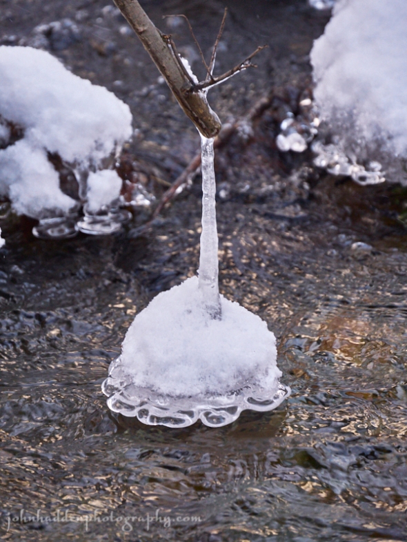
Another fanciful ice structure in Fargo Brook
Morning Observation:
This morning in Huntington at 7:25AM it’s currently 32 degrees under partly cloudy skies. Winds are calm. Relative humidity is 95%, dewpoint 31, barometric pressure 30.17” and rising slowly. We picked up 0.05” of rain in the past 24hrs. We have 5” of snow at the stake. Yesterday’s high was 43, and the overnight low was 32.
Forecast:
The trough that delivered yesterday’s rain is moving to the east this morning as high pressure builds into the region tonight into Sunday. We’ll see clearing skies today with temperatures bumping up into the upper 30s today and tomorrow. A coastal system may bring some mixed precipitation to central and southern areas Sunday night, before an upper trough approaching from the northwest will bring widespread valley rains and mountain snow showers to the entire area Monday and Monday night.
We’ll see cloudy skies this morning giving way to mostly sunny skies his afternoon. Highs will be near 38 with west winds 6 to 8 mph becoming northerly in the afternoon. Tonight should be mostly clear with a low around 20 and light and variable winds.
Sunday should bring a slight chance of rain in the afternoon, then a 30% chance of rain, snow, and sleet by nightfall. Clouds will be on the increase with a high near 37 and calm winds becoming southerly around 5 mph in the afternoon. Little or no snow or sleet accumulation is expected. Sunday night should be mostly cloudy with a 40% chance of rain and snow before 7:00pm, then a chance of snow between later. Lows will be around 29 with calm winds.
Monday should be mostly cloudy with a 60% chance of snow showers early, then valley rain and upper elevation snow showers likely in the afternoon. It’ll be mostly cloudy with a high near 36 and calm winds becoming northwesterly 5 to 9 mph in the morning. New snow accumulation of less than a half inch is possible. Monday night snow showers are likely. It’ll be cloudy with a low around 17 and northwest wind 10 to 14 mph. Chance of precipitation is 70%. Little or no accumulation is expected in valley locations, with 1″-4″ possible over the mountains.
Almanac:
Last year on this date we had a high of 25 and a low of -5. We had 4.5″ of snow at the stake.
Burlington averages for this date are a low of 19 and highs of 33.
The record low was -12 in 1943.
The record high was 54 in 1975.
Sky Notes:
Sunrise: 7:20AM
Sunset: 4:13PM
Length of day: 8:52:29
Today will be 0:31 shorter than yesterday.
The Moon is in its first quarter, 7.3 days old with 48.6% illumination.
Moonrise: 12:31PM
No Moonset
About Today’s Photo:
This dangling ice bell is yet another example of the interesting and fanciful structures that moving water and cold temperatures can create in Fargo Brook.
Panasonic GX8, Lumix 14-140mm lens @ 115mm, ISO 800, f/5.5, 1/200″ exposure.

ha, ha, ha nature is amazing! very cool!
December 15, 2018 at 9:16 am